Rex Belli
Project Description
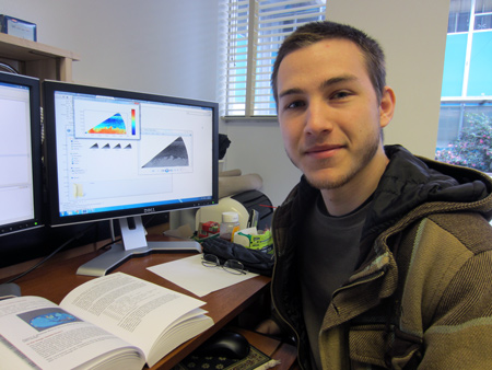
The convective atmospheric boundary layer (CBL) is one that is in contact with the surface of the earth. Over land, it grows during the day. Because the surface of the earth is also a source of particulate matter, aerosol lidars can observe the height of the CBL. My project is to implement algorithms that can objectively identify the top edge of the CBL. Below is an image resulting from one RHI scan from the REAL showing how a simple threshold algorithm identifies the top edge of the CBL. I am currently implementing the Haar wavelet transform method as described by Davis et al. (2000).
Examples
The CBL is driven by either mechanically-generated turbulence (wind shear) or free-convection (buoyancy) or a mixture of each. The following time-lapse animations show the depth of the CBL from sunrise, about 13 UTC, to the afternoon. The black dots are where the Haar wavelet algorithm has found the height of the layer. Note that times are in Coordinated Universal Time(UTC); 12 UTC is equivalent to 4 AM PST, and 00 UTC is equivalent to 4 PM PST.
The animations show that the algorithm incorrectly identifies other features when the CBL does not exist (before sunrise), when other aerosol layers exist above the CBL, or when more complicated vertical structures exist such as clouds or internal boundary layers. In the future, we plan to improve the algorithm so that it identifies the CBL only.
Location: Dixon, CA
Sunrise: 1327 UTC
The algorithm did a very nice job of capturing the growth of the CBL on this day until approximately 18:30 UTC when it begins to incorrectly identify the tops of near surface aerosol plumes and clouds at high altitudes. This explains the erratic nature of the time series trace after 18:30 UTC.
Location: Dixon, CA
Sunrise: 1317 UTC
Although the trace looks reasonable prior to 15:00 UTC, it appear the atmosphere is stable during this time, and the algorithm is incorrectly identifying the top of an aerosol layer. However, after this, we can see evidence of turbulence mixing aerosols and a remarkably constant CBL depth until approximately 17 UTC. By 21 UTC we notice the algorithm is detecting an elevated aerosol layer at 2.7 km AGL. At 23 UTC, an internal boundary layer moves into the scene and the algorithm begins identifying the top of it also.
Location: Dixon, CA
Sunrise: 1315 UTC
Prior to around 15:00 UTC, there is not a well defined CBL, and there are hints of another boundary layer at about 1 km. The algorithm does not do well under these conditions. However, after the CBL becomes more definite, the algorithm is able to pick up on it accurately.
Location: Dixon, CA
Sunrise: 1312 UTC
On this day, it took a few hours, until about 16:30 UTC, for the extraneous boundary layer to die out. After this, though, the CBL is easily found, and a steady increase in its depth can be seen in the trace. At about 00 UTC, a density current front can be seen coming through, and the algorithm incorrectly picks up on this instead.
Location: Dixon, CA
Sunrise: 1304 UTC
This shows a good example of the algorithm. There are a few plumes inside the CBL that the algorithm picks up on, but for the most part, it's smart enough to ignore these. A steady increase in the depth of the CBL can be seen in the trace, as well.
Location: Dixon, CA
Sunrise: 1301 UTC
There was a little growth of the CBL on this day, but after 22:00 UTC, prominence of aerosols above it begin to increase. For the last few hours of this time interval, the algorithm begins to report a second boundary layer.
Location: Dixon, CA
Sunrise: 1259 UTC
Prior to 14:00 UTC, there is some uncertainty to the boundary layer, but after this, the CBL is quite definite. The algorithm is able to plot an increase in the CBL depth all morning, and even the start of a decline as the afternoon sets in.
Location: Dixon, CA
Sunrise: 1257 UTC
The data before 15:00 UTC is quite noisy; the algorithm has a hard time finding the boundary layer. However, it is able to easily pick out the CBL height between the hours of 15 UTC and 23 UTC. After this, the data becomes a little noisy, though the algorithm still does a decent job at determining the boundary layer.
Location: Dixon, CA
Sunrise: 1251 UTC
This is a good case and shows the height of the CBL with relatively little noise. This is true until about 21:00 UTC, when the CBL becomes more turbulent, and the size entrainment zone begins to increase. The algorithm handles this adequately, but as the day wears on, the CBL becomes almost all entrainment zone, and the reported boundary layer is speculative.
References
Davis, K. J., N. Gamage, C. R. Hagelberg, C. Kiemle, D. H. Lenschow, and P. P. Sullivan, 2000: An objective method for deriving atmospheric structure from airborne lidar observations, J. Atmos. Oceanic Technol., 17, 1455-1468.